
Territory and history
The barriers of the Pataxó Coast
Report by Caio Vinícius Gabrig Turbay
May 2025
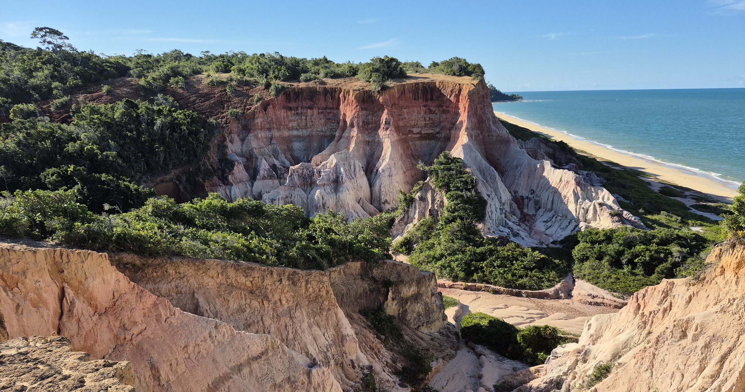
The small “canyon” of Lagoa Azul, in Arraial d’Ajuda, a place that is being lost to predatory mass tourism, a lack of public management, reduced water and silting, all resulting from deforestation in the region. Photo: Caio Turbay, June 2026.
The eyes scan the horizon for signs of land. A few miles from the coast, the shoreline is low, with sparse geographical features hinting at the continent’s proximity. Up close, a firm, continuous band of ochre tones, covered in forest, begins to take shape: the “barreiras” (barriers) described by Pero Vaz de Caminha to the King of Portugal in 1500 during the Portuguese invasion of southern Bahia.
Viewed from the beach, the “barreiras” are imposing. The steep sedimentary cliffs, around 20 metres high, form an almost impenetrable wall, broken only in places where rivers descend from the coastal plateau to meet the sea. Their appearance is striking: earthy tones seen from afar transform into a kaleidoscope of stratified colours, ranging from white to deep red, with shades of grey, beige, and brown.
To the trained eyes of a geologist, the cliffs reveal secrets etched in grains of sand, river pebbles, and fossils. They tell a dramatic story spanning millions of years, when ice sheets in Antarctica and Greenland began forming, leaving this region with a drier, semi-arid climate dominated by savannahs and strange creatures. These geological formations, now scientifically classified as the “Barreiras Group” or simply “Barreiras,” consist of sediments and rocks deposited by rivers and torrents cascading down the slopes during floods, depositing sand, gravel, and clay.
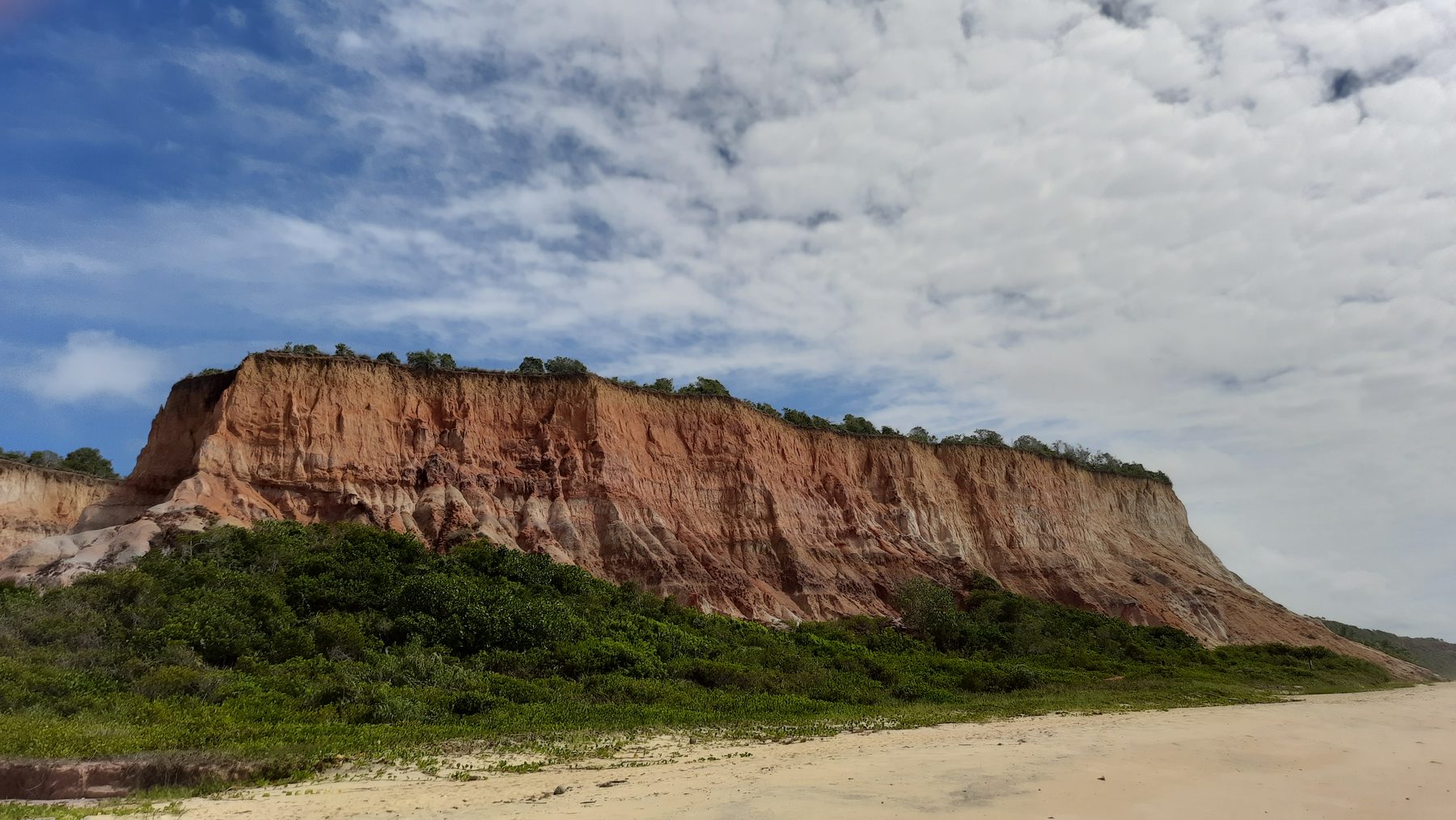
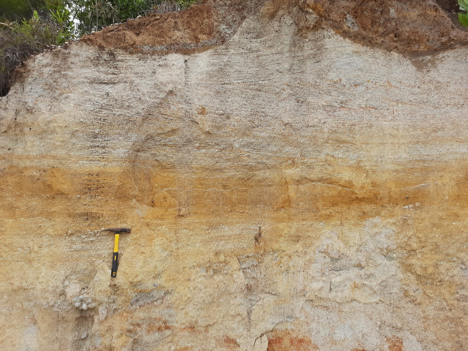
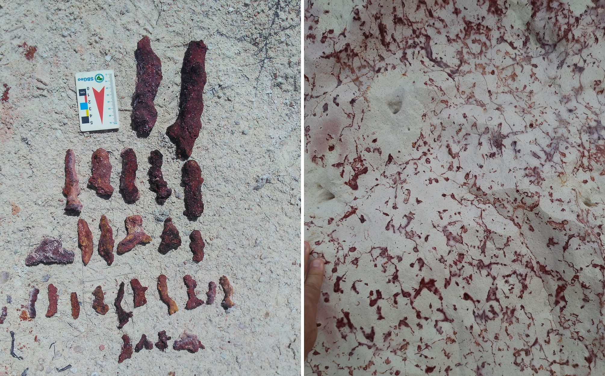
Over nearly 2.5 million years, the Barreiras Group has withstood the planet’s natural forces. Following the last Ice Age, around 11,000 years ago, global atmospheric warming caused polar and mountain ice caps to melt, rising sea levels gradually. This rise triggered marine erosion fronts (the cliffs) that slowly retreated towards the continent.
In the past few millennia, climate changes shifted savannahs inland and allowed rainforests to expand southward, forging a link between the Amazon and the Atlantic Forests. This connection reached its peak in southern Bahia, where ideal conditions of climate, soil, and water fostered an extraordinary blend of plant species, forming the unique Baiana Hileia—a section of the Atlantic Forest sharing remarkable similarities with the Amazon. On the Barreiras coastal plateau, other Atlantic Forest subtypes flourished, such as the tabuleiro forest, rich in palms and vines, and the Mussununga, an ecosystem resembling restinga but at higher altitudes.
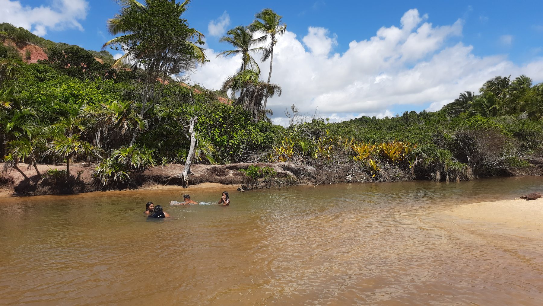
Ideal conditions of climate, soil, and water fostered an extraordinary blend of plant species and the creation of small natural paradises.
Meanwhile, migratory waves brought nomadic peoples to Brazil via Asia and North America. They settled and adapted their cultures to the climatic and environmental changes taking place. If we could travel back 11,000 years, we might witness the ancestors of the Pataxós—today’s inhabitants of the region—hunting mastodons on the Barreiras plateau while defending their children from sabre-toothed tigers. By 8,000 years ago, these groups had harmoniously adapted to dense coastal forests, gathering fruits and shellfish, fishing, and eventually, in historical times, building villages.
This way of life, rooted in respect and adaptation to the land, endured until 500 years ago. The Portuguese invasion brought the cross and the sword. Indigenous peoples, decimated by disease and the brutality of colonisers, survived into the 20th century, resisting the pressures of capitalist society and the territorial encroachments of coronelismo—a legacy of hereditary captaincies. After a massacre at the “mother village” near Monte Pascoal in the 1950s, the Pataxós, legitimate heirs of the territory, began a diaspora across southern Bahia.
Despite five centuries of exploitation, the forest regenerates in areas left undisturbed. The Baiana Hileia remains intact in remote regions. However, a second wave of destruction arrived with the BR-101 highway in the 1970s and 1980s, leading to further deforestation for timber. During this period, families from southeastern Brazil and young people seeking alternative lifestyles arrived in Porto Seguro, drawn by nature and the sea. These newcomers brought wealth, and native families, accustomed to subsistence, were suddenly incentivised to sell their beachfront and prime properties. Thus began a new phase of destruction: urban expansion and real estate speculation. The outsiders claimed the best lands, the finest areas, and economic power.
By the 1990s and into the mid-2000s, Porto Seguro and its surroundings became one of Brazil’s top tourist destinations. Everyone wanted to visit or live in paradise. Native populations were pushed to the outskirts as new developments proliferated—causing even more deforestation. Reflecting federal land rights policies from the 1990s, the Pataxós began reclaiming their dignity by re-establishing villages like Jaqueira and Aldeia Velha.
Real estate speculation surged again in the 21st century, attracting foreign investors and fuelling more development—hotels, condominiums, resorts, and guesthouses. Arraial D'Ajuda coastline became so densely occupied that the sea was barely visible. While the narrow strip of beach at the cliffs’ base prevented further encroachment, the Barreiras plateau above offered sweeping views, making it a prime target.
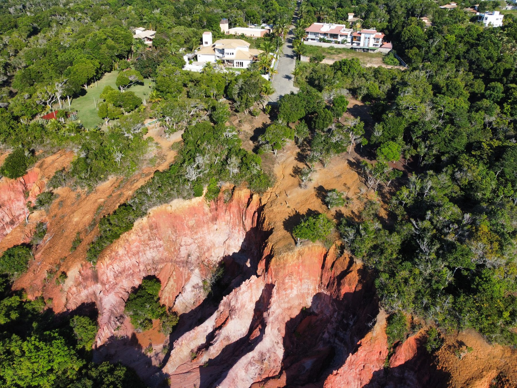
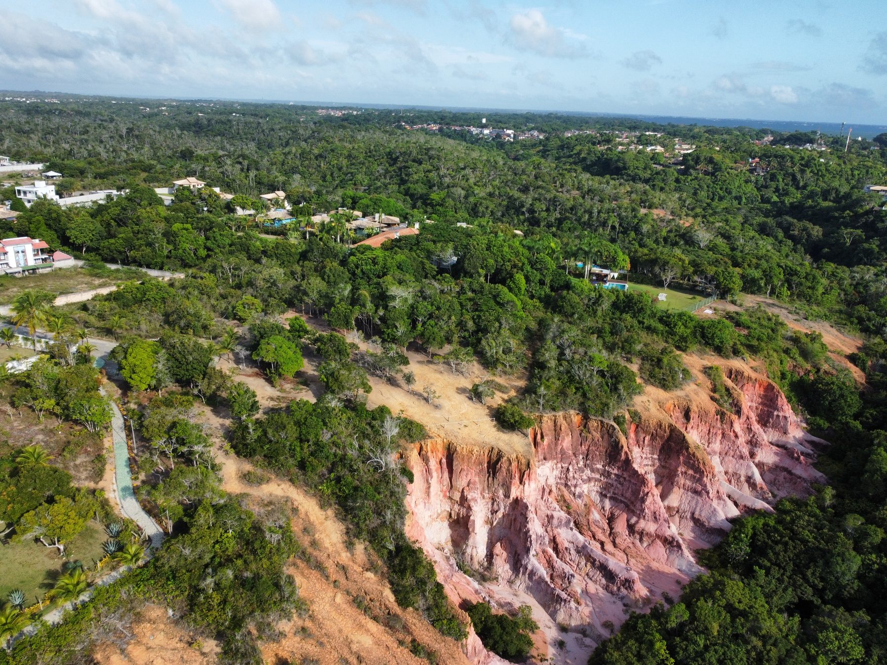
Human ambition may be the very ruin of economic activity in the territory.
The outsider, once wielding the cross and sword, now mingled in this cultural and ethnic melting pot, bringing with them cheap thrills, exhibitionism, and hedonism. A largely alienated Brazilian society embraced these values, legitimising destruction. The Indigenous people, the land, and the forest became irrelevant in the face of profit and “development.” Hotels and developments expanded, archaeological sites were unearthed and destroyed, and the region’s heritage was forgotten.
The future is uncertain. Urban sprawl demands water, extracted here from the Barreiras aquifers. Yet, the water depends on the forest, which, in turn, relies on the Barreiras soil, pollinators, bats, and wildlife from the “tabuleiro” forest, Mussununga, and Baiana Hileia. Climate change has exacerbated extreme and catastrophic events. Without the forest, there is no water, no shelter from storms or winds. The equation is simple, but many fail—or choose not—to understand it.
It is inconceivable that, in just a few decades, greed could destroy a territory millions of years in the making. To preserve the future, we must reclaim ancient wisdom and respect for the land—before it’s too late.
Listen to the podcastEpisode 8 – The Barriers of the Pataxó CoastUma Pedra no Caminho · 20 min · Spotify · in PortugueseSee also
Caio Gabrig Turbay is a husband, father, environmentalist, geologist and university professor. He believes in a world of true deeds, solidarity and respect.
Comments
Your comment will be read and approved before it appears here.